Item 0030 - Letter, 20 June 1881

Open original Digital object

Title and statement of responsibility area

Title proper

Letter, 20 June 1881

General material designation

    Parallel title

    Other title information

    Title statements of responsibility

    Title notes

    • Source of title proper: Title based on content.

    Level of description

    Item

    Reference code

    CA MUA MG 1022-2-1-165-0030

    Edition area

    Edition statement

    Edition statement of responsibility

    Class of material specific details area

    Statement of scale (cartographic)

    Statement of projection (cartographic)

    Statement of coordinates (cartographic)

    Statement of scale (architectural)

    Issuing jurisdiction and denomination (philatelic)

    Dates of creation area

    Date(s)

    • 20 June 1881 (Creation)
      Creator
      Richardson, James, 1810-1883
      Place
      Lévis (Québec)

    Physical description area

    Physical description

    Publisher's series area

    Title proper of publisher's series

    Parallel titles of publisher's series

    Other title information of publisher's series

    Statement of responsibility relating to publisher's series

    Numbering within publisher's series

    Note on publisher's series

    Archival description area

    Name of creator

    (1810-1883)

    Biographical history

    James Richardson was born on March 29, 1810, in Perthshire, Scotland.

    He was a farmer, schoolteacher, and geologist. He immigrated to Canada in 1829, where he worked as a farm labourer in Lachine and later as a teacher in Beauharnois County, near Montreal. Then he was employed by the newly established Geological Survey of Canada as an assistant on surveys of Lake Superior in 1846 and 1847. During succeeding summers, he served as an assistant in the Geological Survey investigations of the geology of the Eastern Townships from the American border to the base of the Gaspé peninsula. Richardson played a major role in the collection of mineral specimens from the Ottawa and Quebec regions, which were included in the Canadian exhibit at the universal exposition in Paris in 1855. In 1856, he became a permanent “explorer” with the Geological Survey. In 1860, he became the first in Canada to use photography to record geological features. In the 1870s, he spent time exploring the coast of British Columbia. In 1878, Richardson Inlet in the Queen Charlotte Islands was named by George Mercer Dawson in recognition of Richardson’s contribution to the geological exploration of Canada. In 1880, he collected specimens for McGill College in Montreal. He also served for a period as cabinet keeper for the Geological Survey.

    In 1831, he married Barbara McConnachay (1811–1885). He died on November 18, 1883, in Matane, Quebec.

    Custodial history

    Scope and content

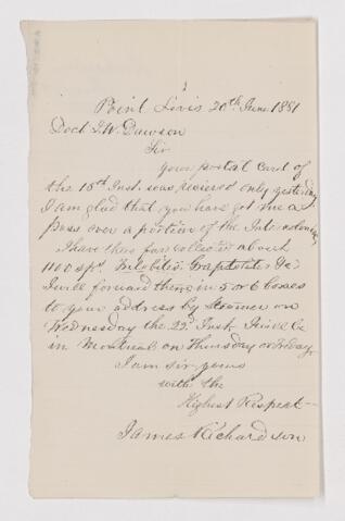
    Letter from James Richardson to John William Dawson, written from Point Levis.

    Notes area

    Physical condition

    Immediate source of acquisition

    Arrangement

    Language of material

      Script of material

        Location of originals

        Availability of other formats

        Restrictions on access

        Terms governing use, reproduction, and publication

        Finding aids

        Associated materials

        Related materials

        Accruals

        Alternative identifier(s)

        Standard number

        Standard number

        Access points

        Subject access points

        Place access points

        Name access points

        Genre access points

        Control area

        Description record identifier

        Institution identifier

        Rules or conventions

        Status

        Level of detail

        Dates of creation, revision and deletion

        Language of description

          Script of description

            Sources

            Digital object (External URI) rights area

            Digital object (Reference) rights area

            Digital object (Thumbnail) rights area

            Accession area