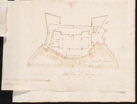
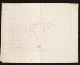
Manuscript plan for riverside structures, possibly related to Item 7 (Plan of a Montreal settlement). Drawn in brown ink on laid paper. Plan does not include a legend. Mountain is marked as being 35 toises high.
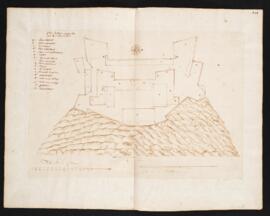
Manuscript plan of Fort Richelieu. Drawn in dark brown ink on laid paper. Includes a legend identifying parts of the structure. Scale statement 6 toises.
The collection consists of 10 ink manuscript maps and plans on paper, some hand-coloured, depicting the earliest settlements and fortifications at Montreal and Quebec City. The earliest dated document is a plan of the fort of Quebec and is dated 1635. The earliest document in the collection depicting Montreal is believed to date back to 1642. The maps and plans were prepared by Jean Bourdon, seigneur and surveyor for the French colony. Included in the collection is a plan of the earliest Fort Richelieu of which nothing had previously been known. There are also detail drawings of riverside fortifications, probably near Montreal.
Manuscript plan of Quebec fort attributed to Jean Bourdon. Drawn in dark brown ink on laid paper. Includes a legend identifying parts of fort. Includes two statements of scale: "Toise pour le fort" (15 toises) and "Eschelle de la Montagne" (230 toises).
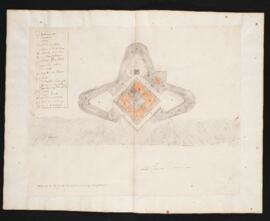
Unfinished manuscript plan of elevated fort, in the style of a bastion fort. Drawn in dark brown ink on laid paper and hand coloured in green and red. Fort has no details beyond external wall.
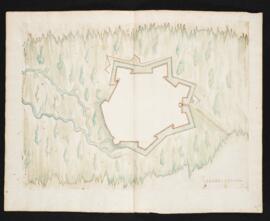
Manuscript plan of a riverside fort with bastion fortifications and a wide ditch. Drawn in dark brown ink on laid paper and hand coloured in blue and red. Includes a legend identifying parts of the structure, with some letters crossed out.
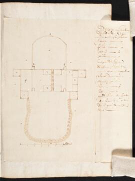
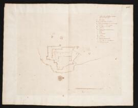
Manuscript plan attributed to Jean Bourdon. Drawn in dark brown ink on laid paper. Includes a legend identifying structures such as towers, sleeping quarters, platforms, palisades, a bakery, a forge, and gardens. Statement of scale 12 toises.
Manuscript aerial view of the platform and magazine of Quebec. Drawn in dark brown ink on laid paper. Includes a legend identifying parts. Statement of scale is 20 toises.
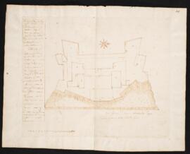
Manuscript plan of Quebec fort. Drawn in dark brown ink on laid paper. Includes a legend identifying parts of fort. Statement of scale is 15 toises. Additional note about scale: "grand fleuve St. Lawrence 660 toize de large. La montage a 35 tois de hauteur."