- CA MUA MG 1022-2-1-393-0006
- Item
- 10 April 1889
Part of Dawson-Harrington Families Fonds
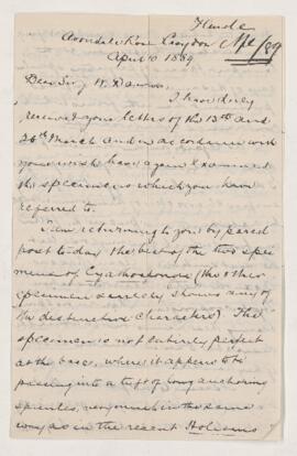
Letter from George J. Hinde to Sir J.W. Dawson, written from Croydon.
Hinde, George Jennings, 1839-1918
Part of Dawson-Harrington Families Fonds
Letter from George J. Hinde to Sir J.W. Dawson, written from Croydon.
Hinde, George Jennings, 1839-1918
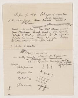
Notes, Paper of 1889 subsequent work
Part of Dawson-Harrington Families Fonds
Page of notes in J.W. Dawson’s hand.
Dawson, John William, Sir, 1820-1899
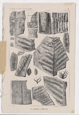
Calamites, ferns, & Triassic fossils
Part of Dawson-Harrington Families Fonds
Calamites, ferns, & Triassic fossils. Geology of Prince Edward Island, sheets II & III with 23 different drawings of fossils. "A.L.D.Delt and LEGGO & co. Montreal" printed on bottom left and right corners.
Part of Dawson-Harrington Families Fonds
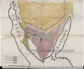
Map of the Sinai Peninsula. Large hand drawn and painted map of the Sinai Peninsula with the Gulf of Suez to the west and the Gulf of Akabah to the east. Includes geological information.
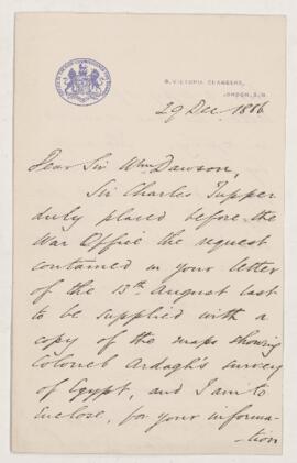
Letter to William Dawson, 29 December 1886
Part of Dawson-Harrington Families Fonds
Letter to William Dawson from Joseph Coleman dated 29 December 1886. Letter accompanies three maps showing Colonel Ardagh's survey of Egypt (see 1022-2-2-3-037-0005 to 1022-2-2-3-037-0007.
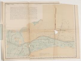
Part of Dawson-Harrington Families Fonds
Map of Egypt. Contains an extensive note on the canals in the Wady Tumilat and Tel-Abu Suleiman; surveyed by Lieutenant Colonel Ardagh, Major Spaight and Lieutenant Burton; lithographed at the Intelligence Branch, War Office, under the direction of Major W.R. Fox.
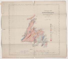
Geological map of Newfoundland
Part of Dawson-Harrington Families Fonds
Geological map of Newfoundland. Includes the text: By Alexander Murray, assisted by Jasper P. Howley. Drawn by Mr. Rob Barlow, draughtsman to the Geological Survey of Canada.
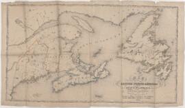
Map of the eastern portion of British North America
Part of Dawson-Harrington Families Fonds
Map of the eastern portion of British North America. Includes the text: Including the gulf of St. Lawrence, and part of the New England states. Compiled from the latest surveys and charts by Henry R. Perley for the report of I.D. Andrews to the Honourable Thomas Corwin, Secretary of the Treasury; engraved on stone and printed by D. McLellan.
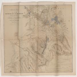
Map of the sources of Snake River
Part of Dawson-Harrington Families Fonds
Map of the sources of Snake River. Includes the text: With its tributaries, together with portions of the headwaters of the Madison and Yellowstone from surveys and observations of the Snake River expedition by Gustavus R. Belcher, chief topographer, and James Stevenson, director.
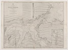
Part of Dawson-Harrington Families Fonds
Map of Pictou Harbour. Includes the text: Surveyed by Captain W.H. Bayfield, assisted by Lieutenants J. Orlebar and G. A. Bedford; London, published according to Act of Parliament a the Hydrographic Office of the Admiralty March 25, 1850.