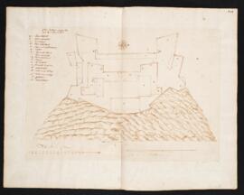
Manuscript plan of Quebec fort attributed to Jean Bourdon. Drawn in dark brown ink on laid paper. Includes a legend identifying parts of fort. Includes two statements of scale: "Toise pour le fort" (15 toises) and "Eschelle de la Montagne" (230 toises).
Unfinished manuscript plan of elevated fort, in the style of a bastion fort. Drawn in dark brown ink on laid paper and hand coloured in green and red. Fort has no details beyond external wall.
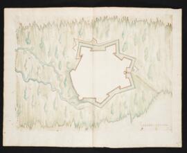
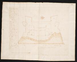
Manuscript plan of a riverside fort with bastion fortifications and a wide ditch. Drawn in dark brown ink on laid paper and hand coloured in blue and red. Includes a legend identifying parts of the structure, with some letters crossed out.
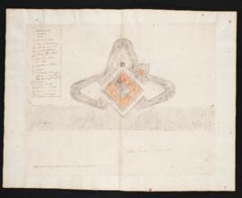
Manuscript plan attributed to Jean Bourdon. Drawn in dark brown ink on laid paper. Includes a legend identifying structures such as towers, sleeping quarters, platforms, palisades, a bakery, a forge, and gardens. Statement of scale 12 toises.
Manuscript aerial view of the platform and magazine of Quebec. Drawn in dark brown ink on laid paper. Includes a legend identifying parts. Statement of scale is 20 toises.
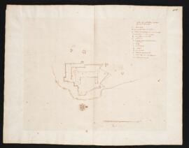
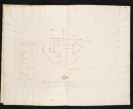
Manuscript plan of Quebec fort. Drawn in dark brown ink on laid paper. Includes a legend identifying parts of fort. Statement of scale is 15 toises. Additional note about scale: "grand fleuve St. Lawrence 660 toize de large. La montage a 35 tois de hauteur."
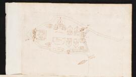
Manuscript plan identified as the the first settlement at Montreal, 1642, possibly on an inlet. Drawn in brown ink on laid paper. Includes buildings such as a chapel and magazine, as well as cannons and a place for small fishing boats ("chalouppe").
Deed of ownership for a plot of land in Ville Marie given to Urban Texier, dit Lavigne. Signed by Paul de La Chomeday, Governor of the Island of Montreal.