- CA CAC SUPC 1-4863
- Item
- 1977
Nova Scotia Department of Municipal Affairs. Mapping.
2 results with digital objects Show results with digital objects
Nova Scotia Department of Municipal Affairs. Mapping.
Kingston (Ont.). Planning Department
Niagara Escarpment Plan: Recommendations of the Provincial Secretary for Resources Department
Provincial Secretariat for Resource Development
Where Magazine International
Correspondence, accounts, journals maps, etc., documenting Bissett’s career with the Hudson’s Bay Company. The Photostats (in C.1 and C.2) include Bissett’s journal and accounts at the Red River, 1854-1855, and a journal “Lachine to the Sandwich Islands” 1858-1859. There are also journals for 1859 and 1867. The original documents (in C.3) include correspondence with the Hudson’s Bay Company, 1858-1875, and accounts, 1860-1873. There are Bissett’s commissions as Chief Trader (1858) and as Chief Factor (1872), and a list of Chief Traders and Factors, 1855-1879. There are also some plans / maps, sketches, and photographs including a sketch of the Hudson’s Bay Post at Honolulu, ca. 1860.
Bissett, James

Part of Joseph Frobisher Collection
File contains a cartographic survey of the land holdings of the Frobisher estate in Montreal created 7 June 1817.
The collection consists of 10 ink manuscript maps and plans on paper, some hand-coloured, depicting the earliest settlements and fortifications at Montreal and Quebec City. The earliest dated document is a plan of the fort of Quebec and is dated 1635. The earliest document in the collection depicting Montreal is believed to date back to 1642. The maps and plans were prepared by Jean Bourdon, seigneur and surveyor for the French colony. Included in the collection is a plan of the earliest Fort Richelieu of which nothing had previously been known. There are also detail drawings of riverside fortifications, probably near Montreal.
Bourdon, Jean, 1601 or 1602-1668
Learned Societies, McGill University, May 30-June 10, 1951 (Program)
This file contains a programme for Meeting of the Learned Societies of McGill University, including schedule of meetings. A campus map is tucked inside the front cover of the programme.
McGill brochures and campus maps
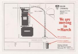
This file contains McGill ephemera with campus maps, including a postcard announcing move of Centre for Continuing Education from Strathcona Hall to the Redpath building (ca. 1982), a booklet containing a walking tour of women pioneers at McGill (Oct 1999), a booklet containing a walking tour of McGill (ca. 1980s), and a campus map (1967).